

Stormwater is surface water resulting from precipitation, such as rain or snow. When it rains or snows, all that stormwater has to go somewhere. First, stormwater runoff makes its way into drainage swales, channels, storm drains, and pipes that carry it away from our homes and businesses. Then, it flows into creeks and streams and, in our area, eventually to the Ohio River. In older parts of our city, stormwater is collected and transported through a combined sewer system. These systems date back to pre-civil war times and are no longer constructed.
In 1986, MSD assumed authority over stormwater drainage in Jefferson County except for in the home-rule cities of Anchorage, Jeffersontown, Prospect, St. Matthews, and Shively. MSD only assumed responsibility for drainage services in Prospect in 2014.
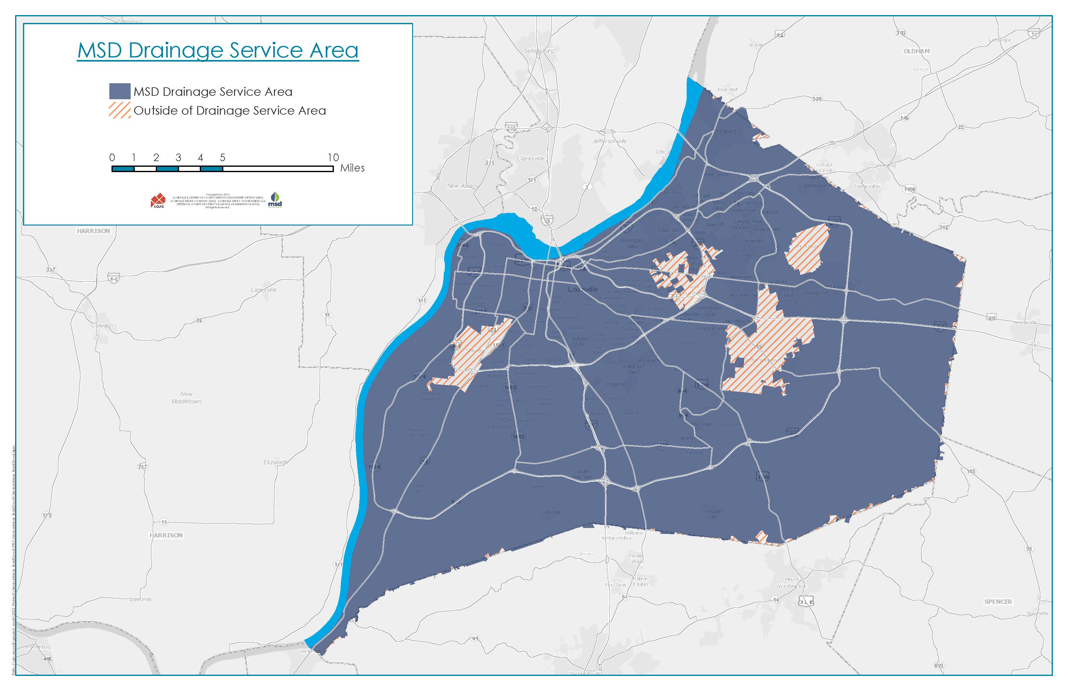
The MSD service area spans approximately 376 square miles, as shown on the map below. This drainage system includes streams, ditches, catch basins, pipes, and other stormwater infrastructure that are critical in helping reduce stormwater impacts in our community.
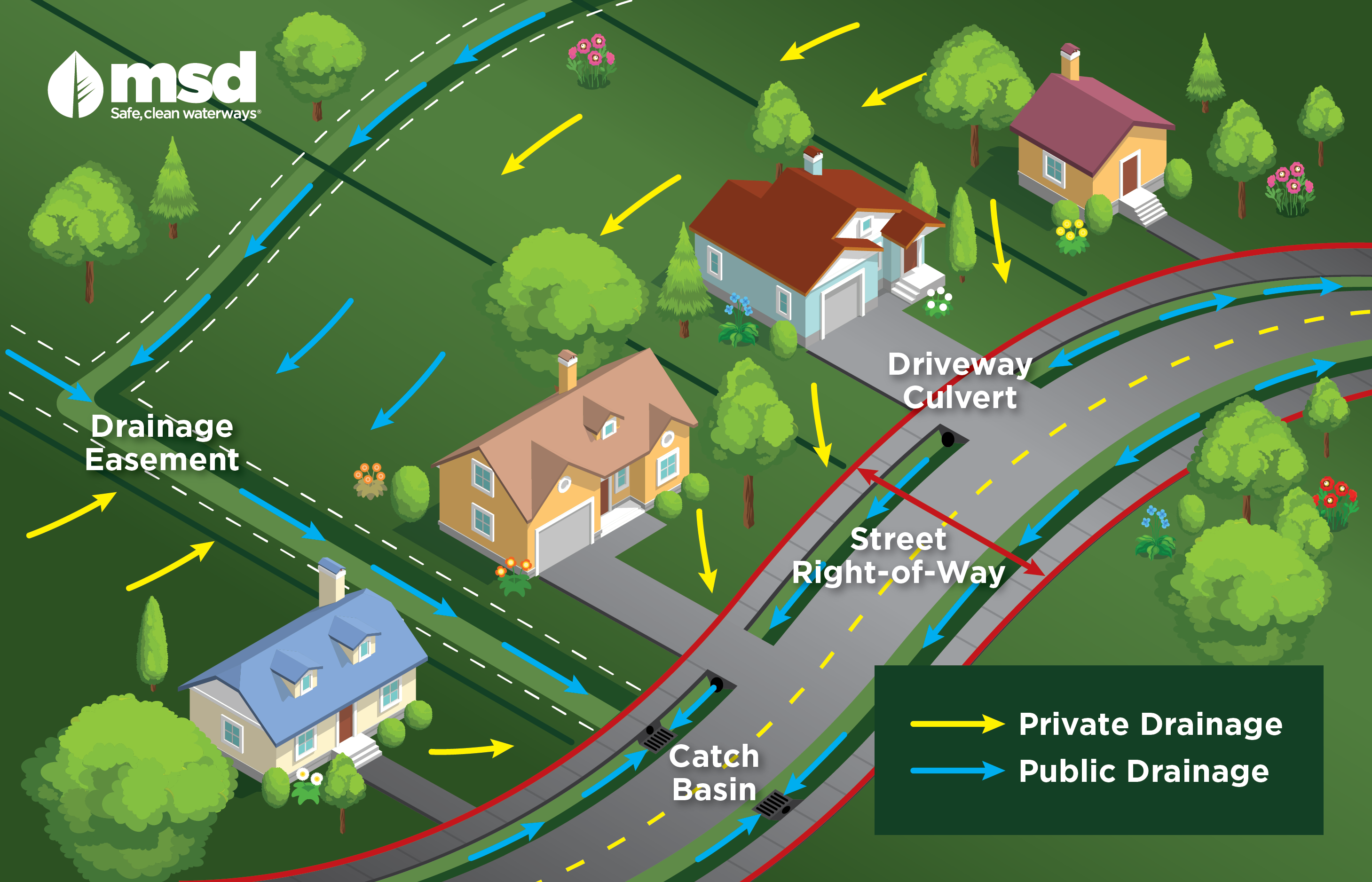
As a stormwater utility, MSD addresses public drainage and is not responsible for private drainage or subsurface water/drainage. Public drainage is water that flows from three or more properties/parcels or from public lands or rights-of-way. The following are examples of public drainage:
- Runoff water from a street that flows onto private property/parcel(s);
- Runoff water from two or more properties/parcels that flows onto another property; or
- Intermittent or perennial streams as defined by USGS mapping.
Private drainage is drainage that flows over only one or two properties/parcels which is caused by conditions on either property/parcel or by a single adjoining property/parcel. MSD is not responsible for private drainage.
The graphic below shows the differences between public and private drainage.
To learn more about stormwater drainage, explore the pages below.


