

Small plant takeovers became controversial for a time, until pressure from state and federal regulators made it clear that their owners would have to make large investments to meet new water pollution regulations. Several court decisions also affirmed that MSD had the power to take over small plant systems when MSD lines reached them.
Even though it had been the policy for three decades to consider small plants as "temporary" measures to treat wastewater until MSD service was available, many small plant operators wanted large payments for their systems. Compromise policies were worked out in the mid-1980s: MSD would negotiate payments with the owners of the small plants, taking over their debts along with their systems, and paying for equipment that could still be used. The customers of the small plants, in turn, would pay a "surcharge" on their new MSD bills until MSD’s acquisition costs had been paid. In most instances, even with the surcharges, customers’ bills were reduced as soon as MSD took over.
The compromises brought results. In the 18 months ending in October, 1986, MSD had entered agreements to buy 43 small plants serving 26,000 customers — about 57 percent of those who had been served by small plants. By the end of 1987, more than 10 small plants had been eliminated. But some small plants would be operated by MSD for more than a decade before trunk sewers could reach them. Under MSD’s ownership, operational standards were usually increased, and stream pollution was usually reduced.
The largest acquisition, in September, 1990, was the Jeffersontown system, serving more than 3,800 customers. The plant, originally slated to be eliminated under the early West County/Pond Creek plan, was saved and upgraded in the early 1990s, becoming one of the subregional plants in the Floyds Fork watershed.
MSD Photo by Martin E. Biemer
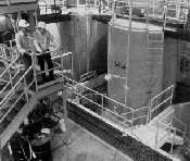
The Morris Forman Plant
The Morris Forman plant reached an encouraging milestone in the summer of 1985: For the first time since secondary treatment began, it met the federal guidelines for water discharged into the Ohio River for three months in a row. And in the fiscal year ending June, 1986, it met the federal guidelines for an entire year for the first time.
Improvements continued at the plant under a plan approved by the EPA through the rest of the 1980s and into the 1990s. While the monthly standards were sometimes exceeded, especially in wet weather, performance continued to improve.
Financing
The "seven percent solution" of 1979 served MSD well throughout the 1980s and into the late 1990s. By keeping its rate increases well below seven percent in any one-year period, and by considering rate increases more often, MSD was able to keep up with inflation without encountering strong public opposition.
In fact, when adjusted for inflation, MSD’s residential rates actually declined from 1979 to 1990, then hovered just above the $10 per month level (in 1995 dollars) through the mid-1990s.
‘LOJIC’ — Computerized Mapping And Geographic Information
In the mid-1980s, MSD took the lead in one of the most ambitious technological projects in the community’s history: a computerized geographic information system, combining highly detailed maps with detailed information about the objects and areas shown on the maps.
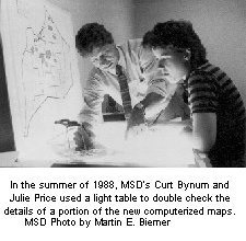
The project was financed by a partnership including MSD, Louisville and Jefferson County governments and the property valuation administrator’s office. Soon the partnership was named the Louisville and Jefferson County Information Consortium (LOJIC).
The first public indication that something new was under way was the appearance of large white circles painted around MSD’s manholes. These identified the manholes for extensive stereo aerial photography, undertaken in the winter of 1985-86 when the leaves were off the trees.
Using the aerial photography, computerized maps were prepared showing a wide variety of natural and man-made features, from rivers to ditches, lakes to ponds, land contours to hedges, skyscrapers to sheds, highways to pathways. Utility poles, fences, fire hydrants, signs, even trees were shown — along with all MSD’s manholes and catch basins.
The maps were checked against U.S. Geological Survey maps and more than 100 other different sets of maps maintained by more than 25 governmental units and public utilities. All of MSD’s sewer lines were mapped — and indexed to data showing the size and depth of the lines, the materials they were made of, and their ages.
Property lines were shown, along with addresses and assessed valuation. Voting information was included: precincts and wards, and districts for legislators, aldermen, county commissioners, congressmen and school board members. Planning and zoning information was also included.
Because of the incredible amount of detail, the computerized maps were prepared in "layers," similar to separate pieces of transparent paper that can be lain one on top of another. One layer may show streets and roads, another may show streams, yet another may show property lines. The layers can be combined in any combination, shown on a computer screen, and printed.
Preparing the original set of computerized maps involved much tedious cross-checking with the old maps — and much effort reconciling the differences among them. The new maps, prepared from the aerial photographs, showed exactly what was there when the photos were taken. As the LOJIC team soon discovered, the old maps didn’t show many things in their precise locations — and the old maps often disagreed among themselves.
MSD took the lead in this effort because of the vital role the maps could play in planning drainage and flood protection projects, as well as sanitary sewer expansion. As the project continued, additional layers would be added to fill the expanding needs of all the LOJIC partners.
MSD History continued - Environmental Activities