Shortly after MSD began its second half-century of service, the community was stricken by the heaviest rainstorm on record — soon followed by the seventh-highest Ohio River flood in history.
MSD Photo by Martin E. Biemer
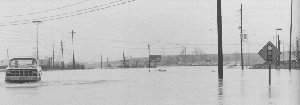
The storms began Friday night, February 28th. By the time they ended 33 hours later, the county had been drenched with from 8 to 12 inches of rain. Nearly all of the floodplains along local streams had been filled; many had overflowed.
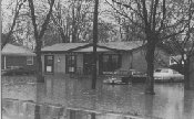
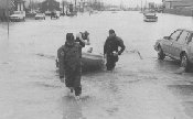
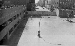
In the former swamplands south of Louisville, streets and entire neighborhoods were flooded. Thousands of homes suffered flood damage.
MSD Photos by Martin E. Biemer
Throughout MSD’s service area, sewer lines were overwhelmed. Water backed up into the basements of thousands of buildings.
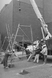
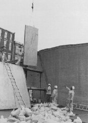
As the storms moved slowly eastward through Kentucky and Ohio, the Ohio River rose rapidly. MSD crews went to work along the floodwall system, installing 24 of the 45 street closures and activating all 15 pumping stations. On Friday, March 7th, the river reached its seventh-highest level on record — 15.76 feet above flood stage in downtown Louisville, or about 26.6 feet higher than normal.
MSD Photos by Martin E. Biemer
It was the second time since the floodwall was completed that the river had risen high enough for it to provide substantial protection; in 1964, the crest had been about 2.5 feet higher. But it was the first time that the flood protection system had worked almost perfectly in a crisis; MSD’s maintenance and training programs had paid off.
MSD Photo by Martin E. Biemer
The local flooding, however, illustrated the need for more action. MSD technicians and engineers began touring the flood-stricken areas before the rain stopped falling, gathering information on water levels and damage. MSD immediately expanded its basement backup program, first offering it to everyone in areas where backups were reported, and then expanding it to all sewer customers.
In the months to come, MSD would launch a major study of the problems in the eastern neighborhoods where basement backups were widespread. And the agency would recommend a revised and expanded floodplain ordinance to Jefferson Fiscal Court, with much stricter provisions than the federal flood insurance program requires.
MSD History continued


